Maps & Navigation Resources
Maps of the Central Kalahari Game Reserve rarely tell the complete truth. When you stare down at fifty-two thousand square kilometres of dry fossil river valleys and scrub-covered dunes, ink on paper feels optimistic. Standard road atlases reduce this vast wilderness to a few sparse dotted lines, ignoring the shifting sands and seasonal mud that decide whether you reach your pitch before dusk or spend six hours with a sand ladder in hand. Navigating this landscape requires a deep respect for terrain and an understanding of why a standard map of central kalahari game reserve botswana can mislead drivers who expect civilized road conditions.
The Cartography of Emptiness
The Kalahari takes its name from the Tswana word Kgala, meaning “the great thirst.” Spanning 52,800 square kilometres, the reserve is the second-largest wildlife reserve on earth, centred around geographic coordinates 22.1921° S, 23.8159° E. Standard satellite mapping platforms struggle here because sand tracks shift after rainy seasons, and heavy rains fill clay pans that stay impassable for weeks. Printable reference materials, including a offline central kalahari game reserve map pdf saved to your tablet, are necessary backups when mobile network signals vanish completely at the park boundaries.
The Anatomy of Kalahari Tracks
Driving through the Kalahari relies on a network of unpaved bush paths rather than managed gravel roads. The primary tracks run along the ancient fossil river beds like Deception Valley, Passarge Valley, and Okwa River. These riverbed tracks feature hard-packed salty soils that offer smooth going during dry months, though they turn into sticky, bottomless clay after heavy summer rains. Away from these low-lying valleys, tracks cross soft sand ridges where deep ruts form quickly, demanding constant momentum and properly deflated tyres.
Drivers frequently encounter parallel ruts created by previous travellers trying to bypass fallen acacia trees or soft sand traps. Choosing which rut to follow depends on ground clearance and track depth. Following the most heavily worn path usually works best, though sharp desert thorn bushes line the track edges and cut sidewalls if you stray too far to the side. You can read more about handling vehicle setups in our guide on 4×4 deep sand driving techniques.
Essential Physical and Digital Mapping Tools
Relying on standard navigation apps like Google Maps inside the reserve is a dangerous mistake. Urban mapping systems calculate driving times based on asphalt speeds, often telling drivers that a 120-kilometre stretch takes ninety minutes. In reality, that same distance in deep sand requires five to six hours of low-range driving. Digital mapping platforms built specifically for overland travel, such as Tracks4Africa, provide real-world travel estimates based on crowd-sourced GPS data from experienced overland travellers.
Digital GPS Platforms
Dedicated GPS devices or rugged tablets loaded with vector maps show precise track geometry, waterholes, campsite locations, and verified gate coordinates. These applications operate without cell service, providing accurate speed calculations over soft sand terrain.
Physical Topographical Maps
Paper maps remain essential equipment. Heat, vibration, and dead batteries can disable electronics without warning. Paper charts allow you to plot grid coordinates, visualize regional topography, and maintain orientation during long cross-country transits.
In the Kalahari, a digital screen tells you where you ought to be, but a proper paper chart and a magnetic compass tell you where you actually are when everything else fails.
Julian Thorne
Key Geographic Coordinates and Gate Entry Points
Access into the reserve is strictly controlled through specific entry gates operated by the Botswana Department of Wildlife and National Parks (DWNP). Knowing the precise coordinates for these gates prevents long detours along the boundary fence cutlines where deep sand slows travel to a crawl. You must present valid entry permits and campsite reservations at the gate before park rangers allow entry into the interior tracks. Check our complete breakdown of visitor rules and entry guidelines for current permit requirements.
| Location / Gate | Latitude / Longitude (Decimal) | GPS Waypoint Format (DMM) | Access Notes |
|---|---|---|---|
| Matswere Gate (Northeast) | -21.2883°, 23.8029° | 21°17.300′ S, 023°48.174′ E | Main gate for Deception Valley & Sunday Pan |
| Xade Gate (West) | -21.9212°, 23.1021° | 21°55.272′ S, 023°06.126′ E | Access from Ghanzi & western wilderness tracks |
| Tsau Gate (Northwest) | -21.2589°, 22.8845° | 21°15.534′ S, 022°53.070′ E | Remote entry point along western cutline |
| Deception Pan Central | -21.5054°, 23.8301° | 21°30.324′ S, 023°49.807′ E | Core game viewing loop and campsite access |
| Bape Camp Waypoint | -22.6800°, 24.1698° | 22°40.802′ S, 024°10.185′ E | Deep southern sector transit node |
Navigating Deception Valley and Kori
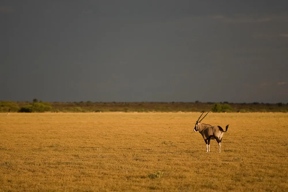
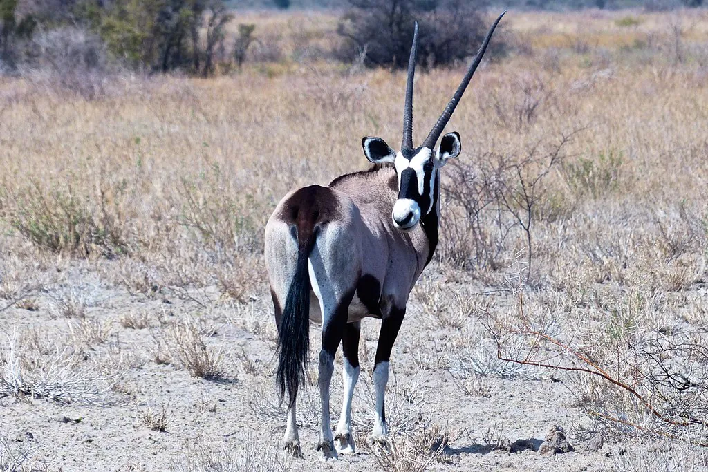
Deception Valley is the most famous geographical feature in the northern reserve. Named by early explorers after the dry riverbed floor that creates the illusion of holding surface water, the valley stretches south-east for nearly forty kilometres. Tracks follow both sides of the valley floor, offering views across open sweetgrass plains where springbok, gemsbok, and black-maned lions gather during the grazing season.
Kori Campsite area sits south of Deception Valley along the same fossil river system. Navigating between Kori and Deception Pan is straightforward because the grassy valley walls form clear natural boundaries. Driving stays smooth on dry clay, but sudden downpours transform the pan floor into sticky mud. Drivers should stay on the slightly elevated track shoulders along the tree line when rain threatens to turn the main track into a swamp.
Deep Wilderness Orientation: Piper Pan and Passarge Valley
Venturing south toward Piper Pan or west into Passarge Valley takes you away from established landmarks. In these open expanses, the landscape flattens into vast plains with few distinctive trees or hill formations. Orienting yourself requires watching track junctions carefully and keeping track of distance logged on your trip odometer.
Passarge Valley features a series of designated wilderness campsites spread along a looping track system. Track signposts consist of low wooden poles with painted numbers that can be obscured by long grass or knocked over by wildlife. Maintaining steady compass bearings ensures you remain on the correct loop when searching for designated campsites late in the afternoon.
Understanding Distances and Driving Times
Distances on a central kalahari game reserve map can be deceptively short. What looks like a simple fifty-kilometre drive between Sunday Pan and Passarge Campsite can take three hours when sand is deep and hot. Midday sun heats the sand, causing individual grains to lose cohesion, which increases rolling resistance and forces your vehicle engine to work twice as hard.
Average travel speeds inside the reserve rarely exceed 25 to 30 km/h. Attempting to drive faster damages the fragile track structure, creates severe corrugations, and risks puncturing tyres on hidden tree roots buried under soft sand drifts. Planning realistic travel times ensures you reach your reserved campsite well before sunset, as driving after dark inside the park is illegal and dangerous.
Campsite Location Layout Charts
Campsites in the Central Kalahari are completely unfenced and spread miles apart to ensure total isolation. Finding your pitch requires cross-referencing your central kalahari game reserve campsites map with ground signposts. Public campsite groups like Deception, Sunday Pan, Leopard Pan, and Passarge each feature individual numbered sites tucked into thickets of bush vegetation around the edges of open pans. For details on campsite amenities and booking fees, consult our comprehensive campsites and accommodation guide.
Deception Campsites (CKDEC01 – 06)
Located in woodland thickets along the eastern ridge of Deception Valley. Sites sit roughly 500 metres apart, offering shaded shade trees, bush pit latrines, and bucket shower enclosures without running water.
Sunday Pan Campsites (CKSUN01 – 04)
Perched on elevated ground overlooking Sunday Pan waterhole. Excellent position for evening game watching, though tracks leading up the dune ridge require low-range four-wheel drive and reduced tyre pressure.
Managing Fuel, Water, and Emergency Supplies
There is zero fuel, water, or food available inside the Central Kalahari Game Reserve. teh nearest fuel stations are in Rakops to the east or Ghanzi to the west. Drivers must top up all fuel tanks and fill extra heavy-duty jerry cans at these staging points before turning onto the dirt access tracks. Vehicles burning diesel or petrol in heavy sand burn up to double their normal highway fuel consumption.
Water requirements are equally critical. Calculate a minimum of 5 litres of drinking water per person per day, plus an additional 5 litres per person daily for basic washing and cooking. Carry emergency water reserves in separate containers to prevent total loss if a primary tank develops a leak over rough corrugated tracks. Additional details on regional climate conditions and heat management are available in our guide to Kalahari weather and seasonal planning.
Emergency Satellite Communications
Mobile phones stop working within ten kilometres of leaving the main tarred highways. A working satellite phone or two-way satellite messenger (such as a Garmin inReach or SPOT device) is essential safety equipment for self-drive expeditions. These devices allow you to transmit exact GPS coordinates to rescue teams if your vehicle breaks down or suffers a catastrophic tire failure deep inside the reserve.
Before entering the reserve, register your travel itinerary with park rangers at Matswere or Xade Gate. Indicate your expected exit gate and intended date of departure. If you fail to check out, rangers launch search operations along your planned route, which is why sticking strictly to your mapped itinerary is something you should commit to.
Reading the Terrain: Salt Pans vs. Clay Mud
The ground underneath your tyres changes character rapidly across the reserve. Recognizing surface texture variations prevents severe bogging incidents. Salt pans feature brilliant white crusts that look flat and smooth, yet seasonal rain trapped beneath the salty surface creates a treacherous slurry that swallows 4×4 vehicles to their axles.

When approaching an open pan floor after recent rains, examine existing tire tracks before proceeding. If tracks appear deep or hold standing water, divert around the pan perimeter along the vegetated dune edge. Hard grass roots provide traction where open clay turns to slick grease. For information regarding guided safaris and escorted convoy options, browse our tours and guided safari resources.
Official Resources and Mapping Channels
Obtaining authentic mapping data and entry permits requires working directly with official Botswana conservation bodies and recognized mapping suppliers. Pre-booking campsites through authorized agents or the Department of Wildlife and National Parks central office in Gaborone or Maun is mandatory before arriving at the entry gates.
- Department of Wildlife and National Parks (DWNP): Official permit issuing authority for park entry fees and government-managed campsites. Direct booking offices operate in Maun and Gaborone.
- Tracks4Africa: Comprehensive paper maps and digital GPS maps formatted specifically for Garmin hardware and iOS/Android mobile apps.
- Botswana Tourism Organisation: Provides official regional travel updates, entry requirements, and official safari operator credentials through the Botswana Tourism Portal.
- Meteorological Services: Check seasonal rainfall patterns and climate alerts through official weather portals like the UK Met Office Climate Guide before entering remote sectors.
Navigating the vast expanse of the Kalahari is an empowering overlanding experience when approached with accurate maps, realistic travel expectations, and proper recovery equipment. Study your route beforehand, respect the shifting desert terrain, and let the slow rhythm of the bush guide your journey across this immense African wilderness.